Omaha Beach France
The beach is located on the north coast of France, facing the English Channel, and is 5 miles long, from the east of Sainte-Honorine-des-Pertes to west of Vierville-sur-Mer on the right bank of the Douve river estuary. Landings here were necessary in order to link up the British landings to the east with the American landing to the west at Utah beach, thus providing a continuous lodgement on the Normandy coast. It was one of 5 landing points on the Normandy coast. Because of its topography the site was easy to defend by the Germans. There were no fewer than fourteen Widerstandnessen (“resistance nests”). Taking Omaha was to be the responsibility of United States Army troops, with sea transport provided by the U.S. Navy and elements of the British Royal Navy.
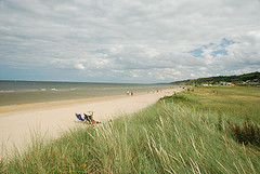
Today at Omaha Beach jagged remains of the harbour are visible at low tide. The shingle bank is no longer there, cleared by engineers in the days following D-Day to facilitate the landing of supplies. The coastal communes of Sainte Honorine-des-Pertes, Saint-Laurent-sur-Mer and Colleville-sur-Mer are under the protection of the Conservatoire du Littoral (an institution which buys coastal land for protection and management). The beachfront is more built up and the beach road extended, villages have grown and merged, but the geography of the beach remains as it was and the remains of the coastal defences can still be visited. At the top of the bluff overlooking Omaha near Colleville is the American cemetery.
Website: Omaha Beach Tourism